
Umer Surveying™
Expert Surveying Solutions and Training
Expert Surveying Solutions and Training
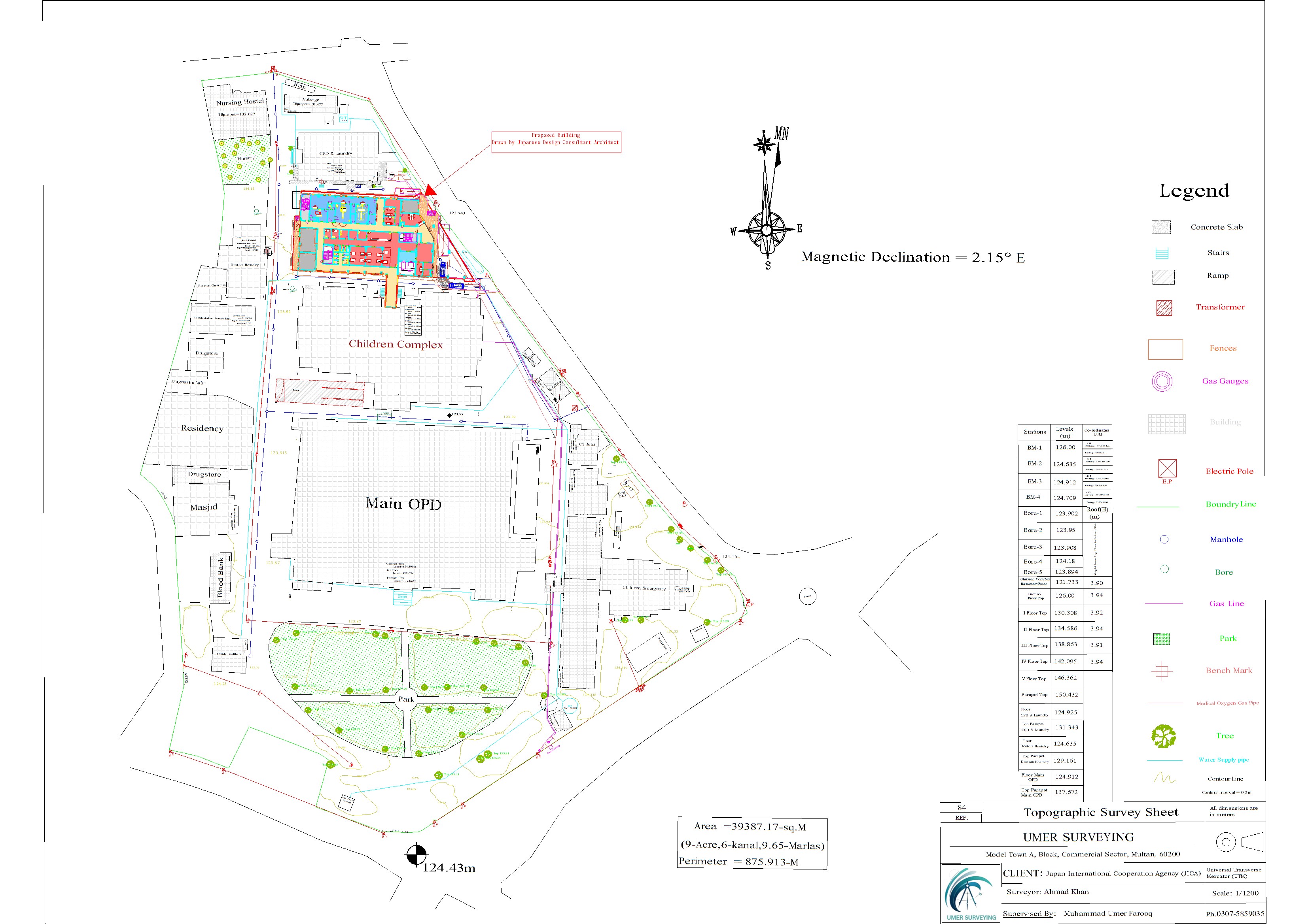


Umer Surveying™ recently had the privilege of contributing to a high-profile international project under the Japan International Cooperation Agency (JICA). The project focused on the topographical and geological survey for the expansion of Children Hospital Multan, commissioned by YAMASHITA SEKKEI INC., a renowned Japanese design consultancy.
Over the course of three months, our skilled team undertook detailed topographic surveys, employing advanced Total Station equipment to ensure the highest levels of accuracy and reliability. This complex assignment required a meticulous and methodical approach to meet the precise standards set by YAMASHITA SEKKEI INC.’s architectural team.
The fieldwork involved collecting accurate terrain data through precise measurements. Following this, the collected data was processed using advanced Computer-Aided Design (CAD) software to produce professional topographical sheets. These outputs adhered to the rigorous quality requirements established for the project, ensuring seamless integration into the overall design framework.
Our unwavering dedication to quality, precision, and professionalism resulted in the successful and distinguished completion of the project. This accomplishment not only reflects our commitment to excellence but also reinforces Umer Surveying™’s reputation for delivering world-class surveying solutions on an international stage.
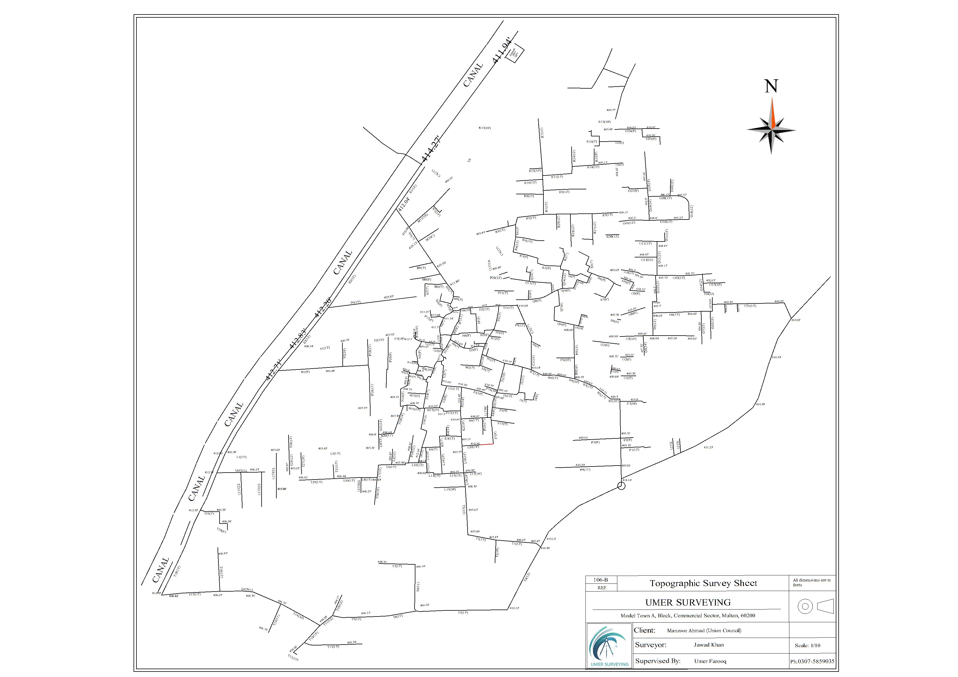
Umer Surveying™ is proud to have successfully conducted a detailed topographic survey for the Urban Planning Project of the Nawabpur Union Council in Multan, Pakistan. This project aimed to provide critical insights into the area’s infrastructure, supporting sustainable urban development and improving living conditions for the community.
Our team, under the expert leadership of Umer Surveying™, utilized cutting-edge technology to ensure accuracy and reliability. Integrating Google Earth Pro software with advanced CAD tools, we carried out a meticulous analysis of the region. Key aspects of the survey included:
Identifying areas in need of rehabilitation to improve accessibility and transportation efficiency.
Conducting a comprehensive review of the sewerage network to highlight gaps and suggest actionable improvements for better sanitation.
The collected data was carefully analyzed and compiled into a highly accurate and detailed topographic sheet, tailored to meet the client’s specific urban planning needs. This deliverable served as a vital resource for decision-making, ensuring the project’s objectives were met efficiently.
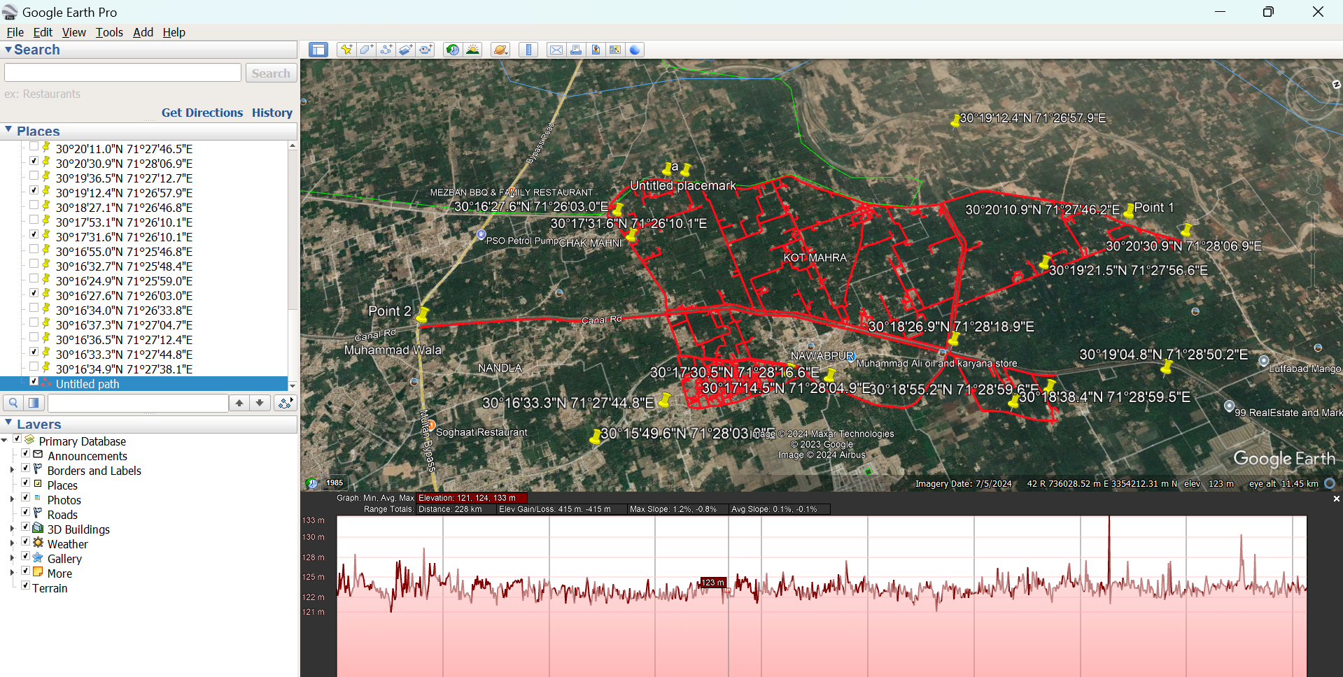
Following the GIS analysis, we systematically transferred quantitative data extracted from Google Earth Pro into Excel sheets for further processing and evaluation. This included detailed measurements of road lengths, elevations, and sewerage coverage. By organizing this data into Excel, we performed in-depth calculations, categorized findings, and generated insightful summaries for actionable recommendations. This step ensured that every aspect of the survey was documented, analyzed, and presented in a clear and structured format, enabling informed decision-making and efficient urban planning solutions.
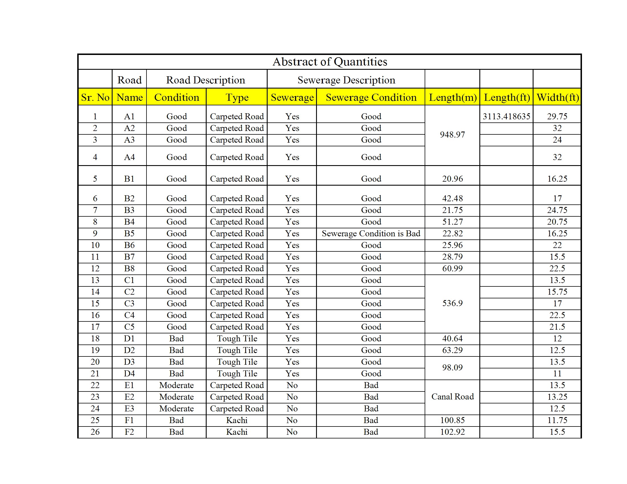
Caption: Sewerage & Transportation Data
At Umer Surveying™, we pride ourselves on delivering precision, professionalism, and innovative solutions. Projects like these highlight our commitment to supporting sustainable development and contributing to the betterment of our communities.